Route map — Freedom Challenge × #TEAMLEN
Annex to the rules and the informed consent
Route map
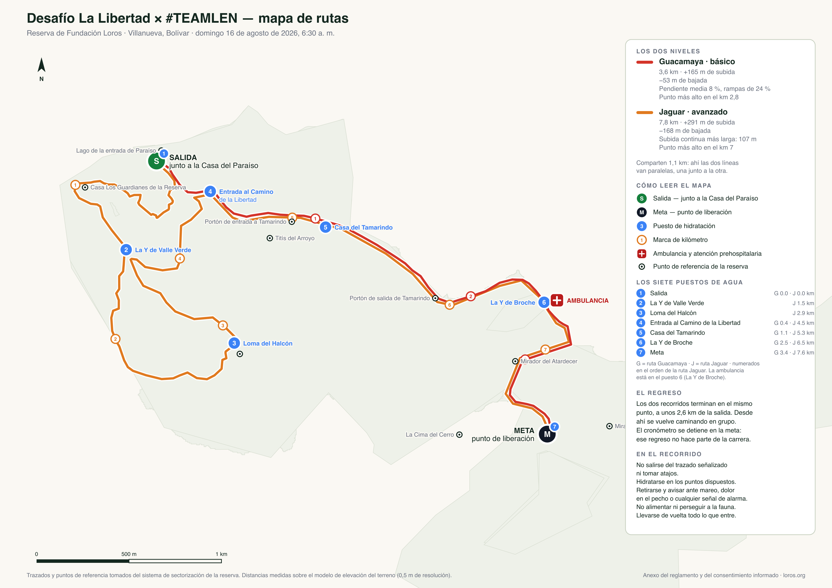
Both routes of the Freedom Challenge, drawn over the real surveyed tracks of the reserve. They start together next to Casa del Paraíso and both finish at the release point, about 2.6 km from the start.
How to read it
- Start (S) — next to Casa del Paraíso. Both levels begin here.
- Finish (M) — the release point, where the closing picnic happens.
- Circled numbers — kilometre markers for each route.
- Numbered blue circles — the seven water stations, numbered in the order of the Jaguar route: 1 the start (Casa del Paraíso), 2 La Y de Valle Verde —long route only—, 3 the point on the Jaguar trail next to Loma del Halcón —long route only—, 4 the entrance to the Camino de la Libertad, 5 Casa del Tamarindo, 6 La Y de Broche and 7 the finish. The map panel shows which kilometre each falls at on each route.
- Red cross — the ambulance and its pre-hospital care crew, at La Y de Broche (station 6): kilometre 2.5 of the Guacamaya route and kilometre 6.5 of the Jaguar.
- Shared section — for 1.1 km both routes run together: there you will see the two lines side by side.
The walk back
From the finish everyone walks back to the rehabilitation centre together, unhurried. That walk is not part of the race: the clock stops at the finish line.
Download the high-resolution map (PNG) · vector version (SVG), for printing
Back to the Challenge page
Day itinerary, levels, registration and how to get there.